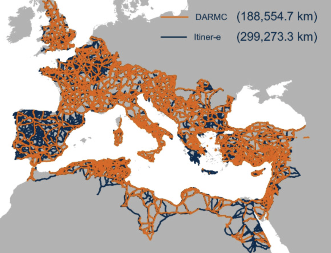

Everywhere you look, you can find traces of the ancient Roman civilization from which the modern West descends. That’s especially true if you happen to be looking in Europe, though echoes of Latin make themselves heard in major languages used all over the world. Take, for example, the common English word itinerary, meaning a planned route for travel, which descends from iter, the Latin word for a journey, route, or path. The Romans eventually spoke of itineraria, which meant more or less the same thing as we do when we speak of our travel itineraries. Now, bridging these distant eras, we have Itiner‑e, a new online map of ancient Rome’s road network, the most comprehensive yet.
Originally envisioned as a kind of “Google Maps for Roman roads,” Itiner‑e is a project of Tom Brughmans of Aarhus University, and Pau de Soto Cañamares and Adam Pažout of the Autonomous University of Barcelona. Its users can digitally explore nearly 300,000 kilometers of roads laid across the vast Roman Empire at its height in the mid-second century — or at least as much of that network as educated guesses can reconstruct.
Researchers can only be sure about less than three percent of the network, with another seven percent of ancient Roman roads documented in existence if not in precise location. Regardless, Itiner‑e is based on an unprecedentedly wide (and open) dataset, which incorporates topographic mapping, satellite imagery and centuries of historical records.
Among Itiner-e’s many features is a confidence rating, which shows just how confident we can be that any given road actually looked like it does on the map. You can also view the whole thing in 3D to get a sense of the elevations involved in construction and travel of the network; use a routing tool to determine suggested routes around the empire “by foot, ox cart or donkey”; and even check satellite imagery to find still-extant parts of Roman roads and draw comparisons with the same parts of the world today. Though a fair few major Roman roads have evolved into current routes for trains and automobiles, we can’t exactly travel on them in the same way the Romans did. Still, when next you plan a European itinerary of your own, consider punching it in to Itiner‑e and seeing how the journey most likely would’ve been made 1,875 years ago.
Related Content:
How the Ancient Romans Built Their Roads, the Lifelines of Their Vast Empire
The Roads of Ancient Rome Visualized in the Style of Modern Subway Maps
A Map Showing How the Ancient Romans Envisioned the World in 40 AD
Built to Last: How Ancient Roman Bridges Can Still Withstand the Weight of Modern Cars & Trucks
The Roman Roads and Bridges You Can Still Travel Today
Plan Your Trip Across the Roads of the Roman Empire, Using Modern Web Mapping Technology
Based in Seoul, Colin Marshall writes and broadcasts on cities, language, and culture. His projects include the Substack newsletter Books on Cities and the book The Stateless City: a Walk through 21st-Century Los Angeles. Follow him on the social network formerly known as Twitter at @colinmarshall.

